SOURCE LAKES:
KEMBO-CUANDO

JULY - AUGUST 2016

The Route

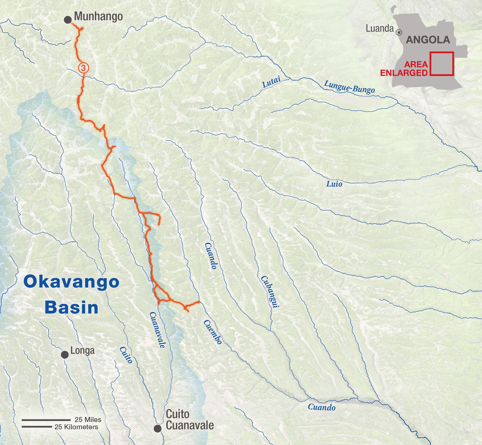
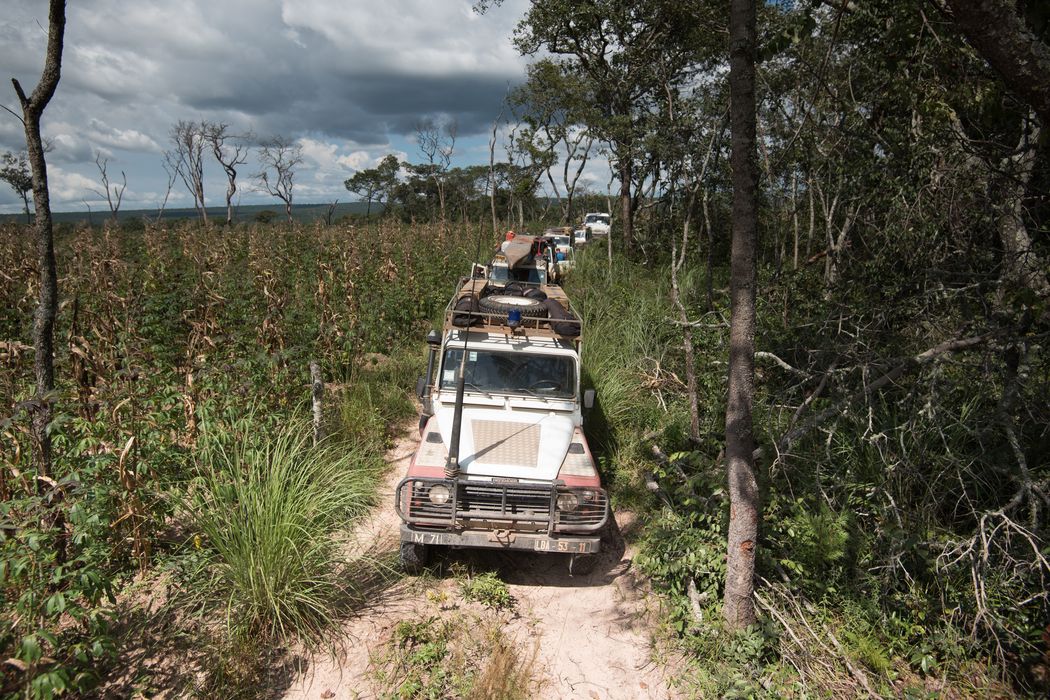
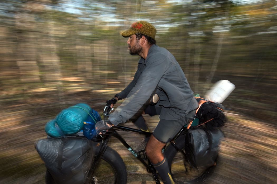
Returning to the source lakes of the Cuito and Cuanavale Rivers that the full team had explored a few months earlier, a four-man team led by Chris Boyes set out to retrace earlier paths and cover new terrain.

They also headed further east to explore the catchments of the Cuando and Kembo Rivers, though they did not explore the rivers themselves.

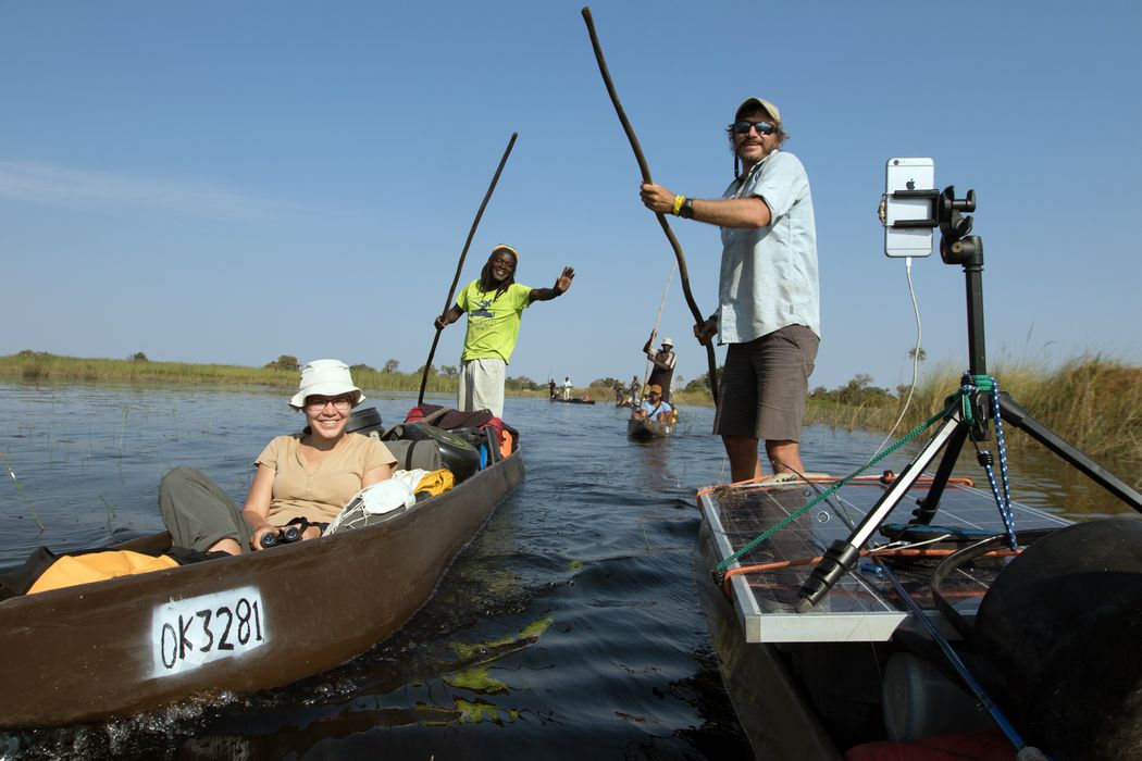
Starting among similar marshy lakes, these two rivers also follow a similar path, flowing southeast and eventually combining and then fanning out into wetlands of their own. Shortly before they would reach the Okavango Delta though, the land rises and forces the waters east. There they join the Zambezi and eventually flow into the Indian Ocean—showing the far-reaching significance of protecting the rain catchment of the Angolan highlands.

MAP BY MARTIN GAMACHE, ART OF THE MAPPABLE

The Mission

Simply reaching the sources of the rivers that feed the Okavango Delta is not enough to understand or protect them. Repeated visits and expanded exploration are needed as well.

The team’s goal this time was to check on the camera traps set a few months earlier. They also continued to document biodiversity and interview villagers to learn more about the socioeconomic situation throughout the region.

To cover large areas of new ground and follow thin trails, they mounted fatbikes. These specially designed mountain bikes have wide-rimmed wheels that can support tires three to four inches wide. They’re able to distribute the rider’s weight over a much wider area, maintaining control on soft surfaces like sand and marsh. Inflated to very low pressure, they cruise over sharp rocks and other obstacles without the risk of puncture. They are ideal for exploring the rough trails throughout this wild area.

The Highlights

After pedaling through more than 100 kilometers (62 miles) of overgrown trail to retrieve two of the camera traps set on the year’s previous expedition, the team was thrilled to discover that not only were the traps still there and functioning, they had caught sight of one of Africa’s rarest cats: the cheetah.

Finding this highly endangered animal in this remote area was further evidence that discoveries could still be made here, and of the importance of protecting the area as a safe haven for wildlife and wild processes.

With a camera in every pocket and solar cells for recharging, the team shared their animal sightings, stunning sunsets, and thoughts and reflections in real time throughout the expedition. See it all in their Instagram feed.

OTHER EXPEDITIONS

PHOTOGRAPHS BY CHRIS BOYES (CYCLIST); GÖTZ NEEF (SOLAR PANEL/BOAT).

Get updates about our critical work to explore and protect our planet.

GIVE TODAY!

The National Geographic Society is celebrating Earth Month. This month only, you can make TWICE the impact to protect Earth’s oceans and natural wonders. Donate to the National Geographic Society to invest in Explorer-led projects and mission programs and help us make remarkable discoveries about the ocean’s intelligent marine life.

National Geographic Explorers are counting on you. Please make your gift today!