ENCYCLOPEDIC ENTRY

ENCYCLOPEDIC ENTRY

Ring of Fire

Ring of Fire

The Ring of Fire, also referred to as the Circum-Pacific Belt, is a path along the Pacific Ocean characterized by active volcanoes and frequent earthquakes. The majority of Earth’s volcanoes and earthquakes take place along the Ring of Fire.


Grades

5 - 8

Subjects

Earth Science, Geology, Oceanography, Geography

Image

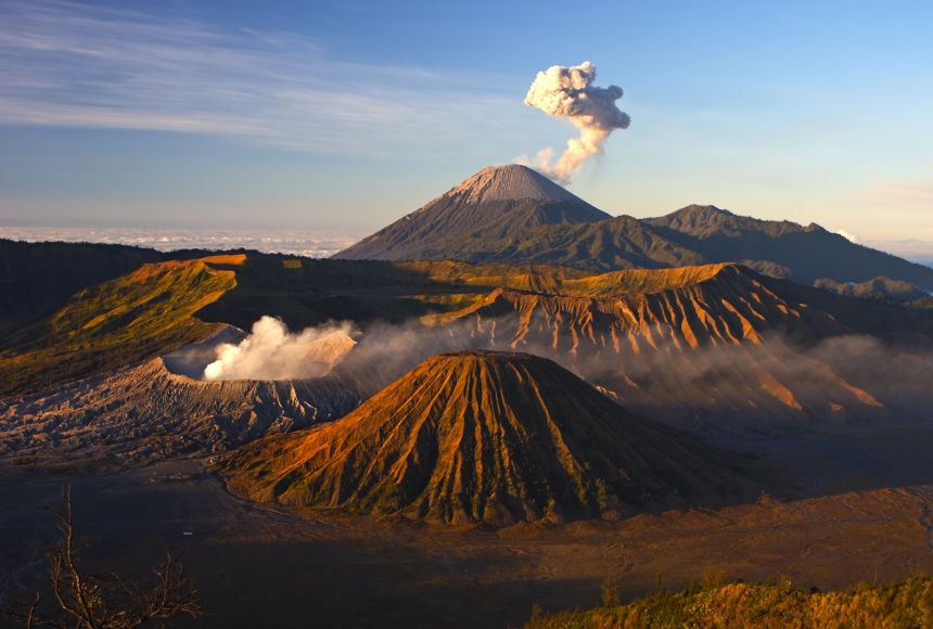
Volcanoes Bromo Nat'l Park

Bromo Tengger Semeru National Park on the island of Java (Jawa), Indonesia, is home to several active volcanoes, which can be seen here smoking ominously against a blue sky.

Photograph by Manamana
Bromo Tengger Semeru National Park on the island of Java (Jawa), Indonesia, is home to several active volcanoes, which can be seen here smoking ominously against a blue sky.

The Ring of Fire, also referred to as the Circum-Pacific Belt, is a path along the Pacific Ocean characterized by active volcanoes and frequent earthquakes. Its length is approximately 40,000 kilometers (24,900 miles). It traces boundaries between several tectonic plates—including the Pacific, Juan de Fuca, Cocos, Indian-Australian, Nazca, North American, and Philippine Plates.

Seventy-five percent of Earth’s volcanoes—more than 450 volcanoes—are located along the Ring of Fire. Ninety percent of Earth’s earthquakes occur along its path, including the planet’s most violent and dramatic seismic events.

The abundance of volcanoes and earthquakes along the Ring of Fire is caused by the amount of movement of tectonic plates in the area. Along much of the Ring of Fire, plates overlap at convergent boundaries called subduction zones. That is, the plate that is underneath is pushed down, or subducted, by the plate above. As rock is subducted, it melts and becomes magma. The abundance of magma so near to Earth’s surface gives rise to conditions ripe for volcanic activity. A significant exception is the border between the Pacific and North American Plates. This stretch of the Ring of Fire is a transform boundary, where plates move sideways past one another. This type of boundary generates a large number of earthquakes as tension in Earth’s crust builds up and is released.


Media Credits

The audio, illustrations, photos, and videos are credited beneath the media asset, except for promotional images, which generally link to another page that contains the media credit. The Rights Holder for media is the person or group credited.

Director
Tyson Brown, National Geographic Society
Author
National Geographic Society
Production Managers
Gina Borgia, National Geographic Society
Jeanna Sullivan, National Geographic Society
Program Specialists
Sarah Appleton, National Geographic Society, National Geographic Society
Margot Willis, National Geographic Society
other
Last Updated

October 19, 2023

For information on user permissions, please read our Terms of Service. If you have questions about how to cite anything on our website in your project or classroom presentation, please contact your teacher. They will best know the preferred format. When you reach out to them, you will need the page title, URL, and the date you accessed the resource.

Media

If a media asset is downloadable, a download button appears in the corner of the media viewer. If no button appears, you cannot download or save the media.

Text

Text on this page is printable and can be used according to our Terms of Service.

Interactives

Any interactives on this page can only be played while you are visiting our website. You cannot download interactives.

Related Resources