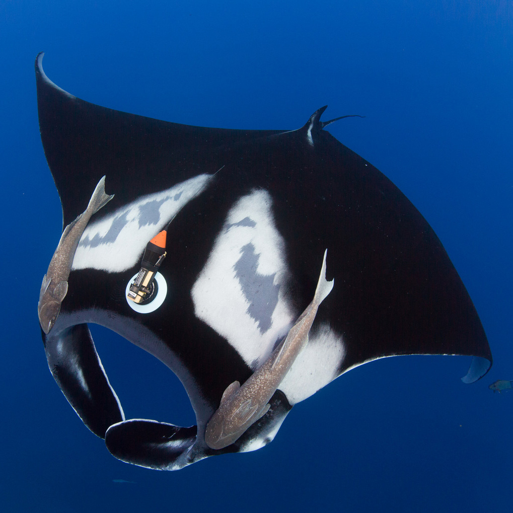
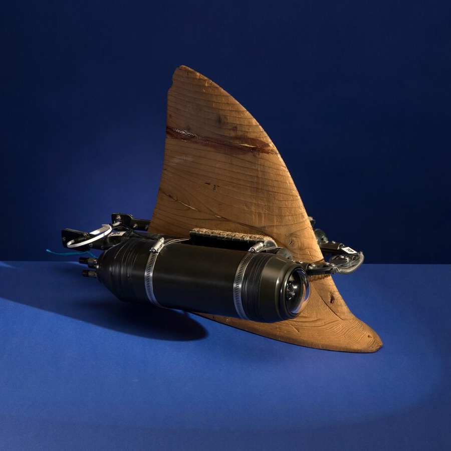
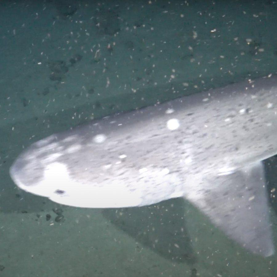
About Exploration Technology Lab
Exploration Technology Lab builds and deploys breakthrough systems and hardware to accelerate exploration and understanding of our natural and cultural heritage.
ExtremE Exploration
Developing and deploying extreme environment technologies that provide unprecedented insights into some of the most extreme and inaccessible environments and cultural heritage sites on Earth.
Deep Ocean Dropcam
Deep Ocean Dropcam is a low-cost, low-logistics research tool for probing the deep ocean. These fully autonomous systems combine a high-definition camera and lights inside a glass pressure housing, and can capture high-quality imagery of the deep sea floor. Dropcams have has been deployed more than 500 times worldwide.
Conservation Technology
Deploying advanced imaging sensors, machine learning algorithms and systems to provide real-time data for monitoring biodiversity distribution, patterns and trends; detecting illegal fishing and poaching; and bringing protected areas “to life”.
TRACKING CRITTERCAM
Carried by wild, free-ranging animals, Tracking Crittercam gathers video that provides highly detailed information on behavior that other instruments or human observers cannot provide. Crittercam data has advanced conservation and research to protect the Hawaiian monk seal, humpback whales, waterbuck, fur seals, African elephants, Tasmanian devils and green sea turtles, just to name a few.
CONSERVATION INTELLIGENCE Initiative
The Conservation Intelligence Initiative develops advanced technologies that empower protected area partners by enabling data-driven conservation. We are developing tools to capture biodiversity, habitat health, and human-wildlife interaction data, as well as to provide, in partnership with Vulcan EarthRanger and Esri ArcGIS, timely information to protected area staff. Together, these tools enable rapid and effective response to illegal activities and threats.
ADVANCED IMMERSIVE TECHNOLOGIEs
Building and deploying groundbreaking imaging and visualization tools, such as 3D scans and ground-penetrating radar, that enable photographers, documentary filmmakers, and science communicators to create transformative stories.
360° CAMERA TRAPS
Exploration Technology Lab, in collaboration with Photography Fellow and wildlife photographer Charlie Hamilton James, has developed novel storytelling technologies. Images from robotic high-speed panoramic camera systems and advanced production-grade camera traps aim to redefine our relationship to the natural world.
3-D AERIAL SCANS
With National Geographic Fellow Corey Jaskolski, the Lab is producing high-resolution 3-D aerial scans of protected areas to support their management, establish a quantitative baseline of the geophysical and vegetative landscape, and produce immersive media experiences for global audiences.
ADVANCED HYBRID DIGITAL SURVEYING
NGS is using LIDAR, photogrammetry and radar to create hybrid digital models of archeologicaL sites for preservation. These “digital copies” allow sites to be explored like never before possible and help answer some of the archaeological mysteries that remain.
Meet Our Explorers
Photographs by Martin Edstrom (Top Image) ; (DropCam Video Sequence) ; Andy Bardon (Extreme Exploration) ; Shelby Randenberg (Dropcam) ; Jen Guyton *NOTE THAT THIS IMAGE IS A COMPOSITE IMAGE CREATED BY COMPILING PHOTOS TAKEN AT 1 MINUTE INTERVALS OVER THE COURSE OF A DAY (Next Generation Camera Trap) ; Greg Marshall (Tracking Crittercam) ; Beverly JouBert (TRailGuard Anti Poaching System) ; DAVID YODER (Advanced Immersive Technologies) ; Charlie Hamilton James (360 degree camera Traps) ; Corey Jaskolski (3-D Aerial Scans) ; (Advanced Hybrid Digital Surveying) ; TERRY VIRTS/NASA (Geographic Visualization) ; KARINE AIGNER (CITIZEN EXPLORER) ; MANU SAN FÉLIX (IMPACT PROGRAMS)