IDEA SET
IDEA SET
Animal Migration
Animal Migration
Investigate several examples of animal migration, including migration by monarch butterflies, pronghorns, and animals of the Florida Wildlife Corridor.
Grades
5 - 8
Subjects
Biology, Ecology, Geography, Physical Geography
Photograph by Alex Edelman / ZUMA Press, Inc. / Alamy Stock Photo
Many animals journey great distances, or migrate, as part of their life. They do this for various reasons, including to mate and find food. Use this idea set to learn about several migratory species, including monarch butterflies and the challenges faced by these insects. Additionally, introduce students to pronghorn migration through the camera lens of photographer Joe Riis to understand how the Geo-Inquiry Process was used to learn the importance of migration bridges. Lastly, visit the Florida Wildlife Corridor through a conservation photographer’s experience to learn how corridors can facilitate wildlife movement across large areas.
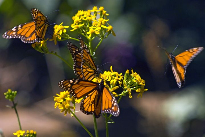
Migrating Monarchs
Trace the migration of monarchs through North America to better understand the challenges these insects face. Read this article to begin. According to the article, how do monarchs use milkweed? Then introduce this map of monarch migration and have students identify specific locations where monarchs breed and feed throughout the year.
Direct students to compare this migration map to other maps as they assess possible issues monarchs may face along their migration route. Students can begin by using MapMaker's Land Cover and Population Density map layers, as well as MapMaker's Streets base map to understand how land is used along migratory routes. As students compare the migratory routes to the MapMaker data, have them create a list of possible issues monarchs may face, especially considering their dependence on milkweed. Example responses may consider the impact of highways, cropland, and dense urban areas. Students can compare their lists to the threats scientists have identified using this article.
As an extension, have students develop plans to build or improve upon monarch-friendly landscaping on their campus, or if they live in an area outside of monarch habitat, develop recommendations that other schools might use. Encourage students to share their plans with the school’s administration.
Bridges for Migration
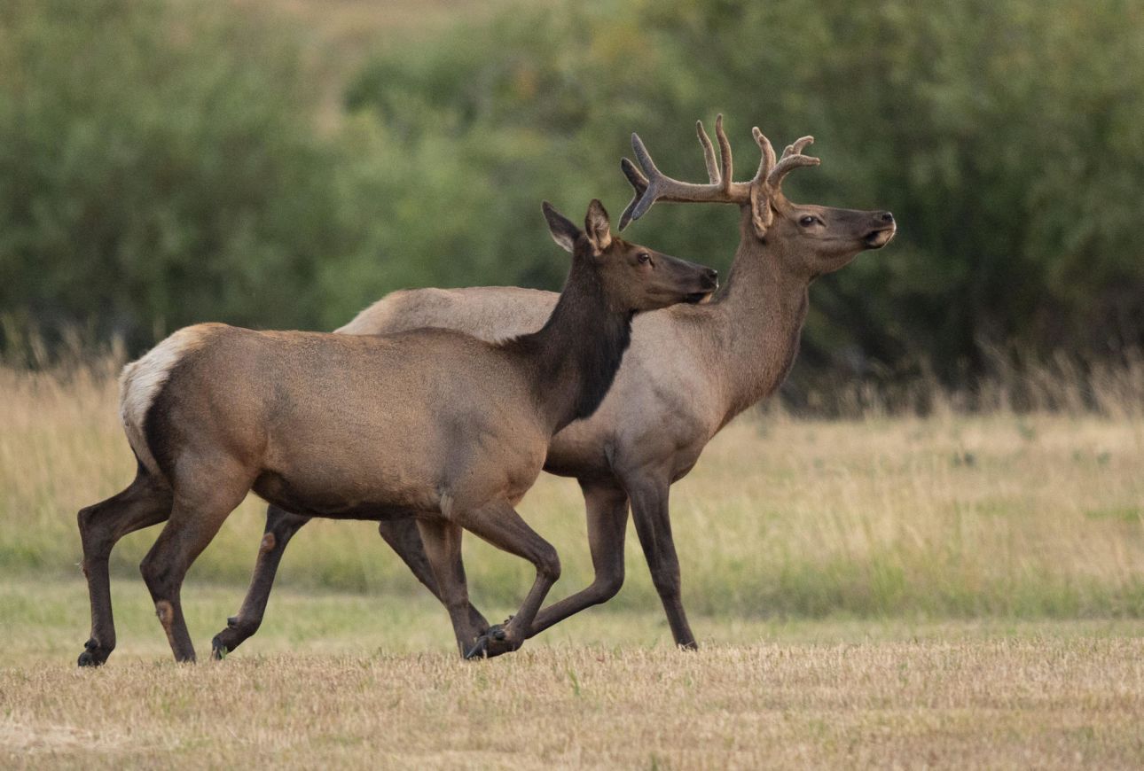
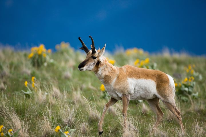
Investigate the use of wildlife bridges to help facilitate animal migration. As a class, begin by reading this story about Joe Riis, a National Geographic Photography Fellow. Students can answer the following questions as they read: What is a pronghorn? What did Joe Riis want to find out about pronghorns? How did he obtain information about pronghorns? What was he able to show with the information? What impact did his work have on pronghorn migration? In what way can his work help other migrating animals and humans?
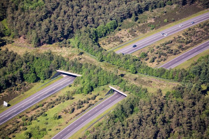
Emphasize the use of wildlife bridges by reading this article to determine where else in the world they are used and what makes them successful. Then explain how Joe Riis used The Geo-Inquiry Process to help him develop a geographic perspective in order to determine the importance of wildlife bridges. List the steps of The Geo-Inquiry Process (Ask, Collect, Visualize, Create, and Act) on the board. Help students identify the steps of the process by specifically connecting them to Joe Riis’ work: Ask—What questions did Joe ask? Collect—What data did he collect? Visualize—What visuals did he create? Create—What did Joe create from his work? Act—What actions occurred following his work?
Tell students they can conduct their own geo-inquiries using these steps. Encourage students to brainstorm a local environmental problem they are interested in learning about and addressing, especially those pertaining to wildlife crossings. Use the teacher resources on this site for information and handouts to help students start a Geo-Inquiry project.
Wildlife Corridors
Explore the use of wildlife corridors using Florida as a model. Students can start by using the street and satellite views on Google Maps to predict which areas across Florida are likely natural habitat and home to a variety of wildlife. Students can base their predictions on the land cover or the locations of identified protected areas. Emphasize the unconnected nature of these areas by, for example, pointing out the distance between the Ocala National Forest and Goethe State Forest. Ask students to speculate why having unconnected natural habitat might cause issues for wildlife. Then have students propose paths, or corridors, that could help facilitate wildlife movement between the areas they identified earlier. Students can compare their proposals to the proposed Florida Wildlife Corridor depicted on these maps.
Describe the Florida Wildlife Corridor as a proposed network of connected land and water stretching across the state that is designed to support native wildlife. Students can watch this video of National Geographic Grantee Carlton Ward Jr., who founded the Corridor project, to learn more. As a class, discuss how Ward Jr.’s work as a conservation photographer might be helpful to successfully implementing the Florida Wildlife Corridor.
To conclude, share this article about the creation of a wildlife corridor in Brazil. Students can use both projects as examples as they evaluate the advantages and difficulties of implementing wildlife corridors.
Media Credits
The audio, illustrations, photos, and videos are credited beneath the media asset, except for promotional images, which generally link to another page that contains the media credit. The Rights Holder for media is the person or group credited.
Director
Author
Production Managers
Program Specialists
other
Last Updated
April 16, 2024
For information on user permissions, please read our Terms of Service. If you have questions about how to cite anything on our website in your project or classroom presentation, please contact your teacher. They will best know the preferred format. When you reach out to them, you will need the page title, URL, and the date you accessed the resource.
Media
If a media asset is downloadable, a download button appears in the corner of the media viewer. If no button appears, you cannot download or save the media.
Text
Text on this page is printable and can be used according to our Terms of Service.
Interactives
Any interactives on this page can only be played while you are visiting our website. You cannot download interactives.