IDEA SET
IDEA SET
Growing Pains—and Plans
Growing Pains—and Plans
This set of classroom ideas addresses worldwide urban growth and how to plan for it.
Grades
6 - 9
Subjects
Anthropology, Sociology, Geography, Social Studies

Photograph by Getty Images
Cities are the future. According to the United Nations, about 55 percent of the world’s population lives in urban areas, a number projected to rise to 68 percent by 2050. Natural population increases and the migration of people from rural areas to cities in search of economic opportunity are two reasons cities are growing. This rapid urbanization does not have to mean urban sprawl, however. The growth of the world’s cities comes with risk and challenges, but also tremendous opportunity, if it is managed correctly. Introduce students to the key role that urban planning by governments, city leaders, and active citizens plays in healthy and sustainable growth of cities with the lesson ideas below.
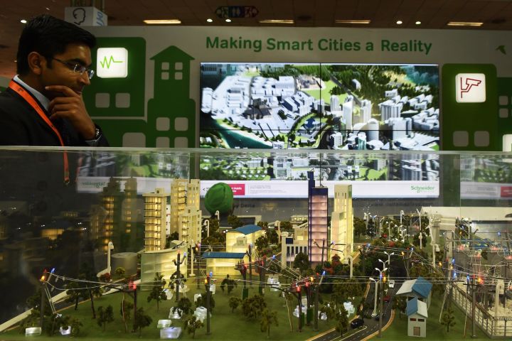
Smarten Up, City
Introduce students to the idea of a smart city with this article. Have students research the top ten smart cities in the world according to the most recent IESE Cities in Motion Index, mapping their locations in Mapmaker Interactive with the marker feature. Then have students attach a text label to each marker to briefly indicate what makes each city “smart.” Next, have students narrow their focus to the United States. Ask students: Is their city a smart city? If so, in what ways? If not, where is the closest one? One way cities can be made “smarter” is with improvements that enhance quality of life for people while minimizing negative impacts on the environment. Share the “10 Green Ways to Improve Our Cities” infographic with students. How green is their city’s “smartness?” What additional smart measures could be taken to make their city more efficient and sustainable? Using the infographic and their research discoveries, have students brainstorm five ways to make their city smarter.

LRT for ATX
Show students this photo of traffic congestion on I-35 in Austin, Texas. Question students about the human and environmental impacts of traffic congestion (wasted time, road rage, pollution, etc.), and then invite suggestions about alternatives to traveling by car on congested routes such as this one. Discuss light-rail transit as one public transportation option that has become popular in U.S. cities in recent years. Have students research the pros and cons of light-rail transit compared to other options like buses or subway systems. Inform students that they have been hired as traffic planners to fix Austin’s traffic problems by implementing a light rail in the city. Have students identify the city’s most congested routes using this map and this list of the 11 most congested roads. Ask students if they should plan their light rail lines to complement the city’s single existing MetroRail line and service important business, recreation, and educational sectors of the city, and have them explain why or why not.
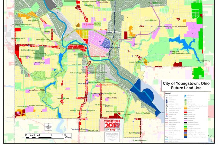
Operation Redesign
Provide students with an overview of urban planning with this article. Then introduce students to urban planner William D’Avignon for insight into a real-world application for this type of work. Discuss the city of Youngstown’s unique needs and D’Avignon’s ideas for revitalizing the city. Review the Youngstown 2010 Plan together. Discuss the major vision principles, or platforms for the urban plan, and ask students to compare the two maps depicting current and future city land use. Ask students: What changes have urban planners like D’Avignon proposed? How will these changes help meet the city’s evolving needs? Next, inform students that they, like D’Avignon, have been hired as urban planners for their own city or town. Their first task is to evaluate the physical layout of their city and assess the physical, social, and economic needs of the population using maps and resources available on their city or town website. Instruct students to use their research to inform their ideas in order to create their own four “vision principles” for a redesign of their city and a map illustrating their plans for improving the city layout and land or resource use. Make sure that the students’ plans address improvements in city services, recreational and “green” space, housing, and roads and transportation.
Media Credits
The audio, illustrations, photos, and videos are credited beneath the media asset, except for promotional images, which generally link to another page that contains the media credit. The Rights Holder for media is the person or group credited.
Director
Author
Production Managers
Program Specialists
Producer
Intern
other
Last Updated
December 15, 2023
For information on user permissions, please read our Terms of Service. If you have questions about how to cite anything on our website in your project or classroom presentation, please contact your teacher. They will best know the preferred format. When you reach out to them, you will need the page title, URL, and the date you accessed the resource.
Media
If a media asset is downloadable, a download button appears in the corner of the media viewer. If no button appears, you cannot download or save the media.
Text
Text on this page is printable and can be used according to our Terms of Service.
Interactives
Any interactives on this page can only be played while you are visiting our website. You cannot download interactives.